The excitement in visiting Son revolves around two subjects. One is, what new rules and regulations have the guest harbor authorities come up with this year. The other is, what new cuisine, if any, do we find in Thornegården. Well, this year it appears last years newcomer, a tapas restaurant, disappeared only a few days ago. As for the guest harbor rules, they are just getting more confusing, which might explain why arriving yachts swirl around the place a lot before settling on where to dock.
Son
Latitude: 59° 31.44 N Longitude: 10° 41.057 E
Click chart to view larger scope, or here for an even larger scope in a separate window.
Holmsbu has become the second ‘must’ stop on our summer cruise. I might have mentioned a certain shrimp sandwich in earlier entries. In fact, I was planing to take a picture for the blog, but the moment the sandwich was placed in front of me, my brain switched from blog mode to eat mode. Maybe next time…
Holmsbu
Latitude: 59° 33.67 N Longitude: 10° 25.497 E
Click chart to view larger scope, or here for an even larger scope in a separate window.
A while since we have been here. Last time, the new guest harbor was established but not finished, no water or shore power. Now it is all finished. In nice weather, this is a beautiful place.
Åsgårdstrand
Latitude: 59° 21.02 N Longitude: 10° 28.349 E
Click chart to view larger scope, or here for an even larger scope in a separate window.
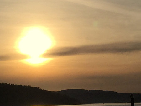
When we set out it was miserable weather. When we arrived the rain had cleared and later it turned into a beautiful evening at this charming old fishing-boat harbor.
Fresh shrimp
The charm-scale peaked when the “harbor-master,” an old guy that oversaw the disused fishing-boat dock, gave us a load of freshly caughtshrimp.
However balance was soon restored. A westerly wind will send waves into the bay and beat the boat against the dock. This we learned during the night.
Papperhavn
Latitude: 59° 6.282 N Longitude: 10° 50.543 E
Click chart to view larger scope, or here for an even larger scope in a separate window.
We spent a couple of lazy days in Hankøsundet. It has become a ‘must’ stop for our summer cruise and it was a pleasant relief from the waves on the seaside of Hankø.
Hankø Marina
Latitude: 59° 12.824 N Longitude: 10° 47.289 E
Click chart to view larger scope, or here for an even larger scope in a separate window.