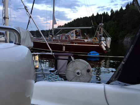
Our next-door neighbor, just a leap away at the closest
We often prefer anchor or buoy over quay or pontoon, if there is a choice at our selected destination. Privacy is just partly the reason. The feeling is freer and more outdoorsy, when surrounded by water rather the other boats. And we like that feeling. But not all agree. Some prefer to anchor right next to others, even though there is plenty of space at the anchorage. This is the magnet effect.
Ostøya
Latitude: 59° 52.581 N Longitude: 10° 34.73 E
Click chart to view larger scope, or here for an even larger scope in a separate window.
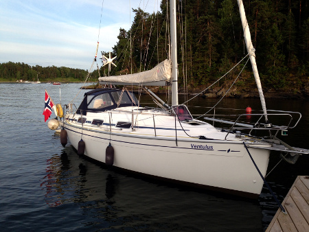
I am pretty sure this is the duck we fed pita last weekend. So I assume she boarded Ventulus for more pita, and not because she share our taste in music.
Lille Ostsundet
Latitude: 59° 52.574 N Longitude: 10° 35.016 E
Click chart to view larger scope, or here for an even larger scope in a separate window.
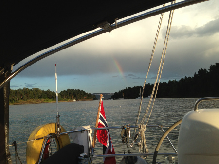
Surrounded by party boats, we decided to have our own party.
The ambiance has changed a bit since the last time we where here, when the anchorage was filled with pleasure crafts and the sound of many small polite dinner parties, to now with as many as eight party boats simultaneous, stuffed with loud, obnoxious, company financed drinking orgies. So, we decided we could party too.
Ostøya
Latitude: 59° 52.636 N Longitude: 10° 34.712 E
Click chart to view larger scope, or here for an even larger scope in a separate window.
A sailing hammock. Both crew members occupied the hammock seconds before the picture was taken
Situated on route from the home port of the western Oslo pleasure boat fleet, to the ‘open’ waters of the inner Oslofjord, anchorage between Ostøya, Kjeholmen and Grimsøya has a steady onset of boats passing through. Every now and then, strange things float by. A sailboat is not strange in it self, but when the crew occupies the hammock while under sail it registers as strange.
A sailing scaffold
..and then there is this.
Ostøya
Latitude: 59° 52.636 N Longitude: 10° 34.712 E
Click chart to view larger scope, or here for an even larger scope in a separate window.
Bonfire at FB1860 harbor on Ostøya (no people were burned)
We enjoyed the typical ingredients of a Norwegian midsummer eve celebration (i.e. bonfire and boating), in Ostsundet this year. We were not alone, even though it fell on a Monday.
Ostøya
Latitude: 59° 52.595 N Longitude: 10° 34.6104 E
Click chart to view larger scope, or here for an even larger scope in a separate window.
I spent a fine summer evening with colleagues at FB1860’s private port at Ostøya. It is private; you need to be member, so I am not going to talk it up more. Those of you that do not have access, may take comfort in the fact that this must be one of the most mosquito infested spots in Oslofjorden, to such a degree, that the popular name for the place is ‘Mosquito Bay’.
Ostøya
Latitude: 59° 52.595 N Longitude: 10° 34.6104 E
Click chart to view larger scope, or here for an even larger scope in a separate window.
It was a little windy at this well protected anchorage, as we enjoyed the last of the sunset, just before we retired below to watch an episode of Dexter. Well into the episode a slightly dramatic scene was enhanced by a loud bang, a little more natural than what our otherwise excellent sound system could reproduce. A 40′ Hansa had pulled its anchor out of the mud and descended on our bow. At least three times the depth, people! Repeating: minimum 3 x depth!
Ostøya
Latitude: 59° 52.574 N Longitude: 10° 35.016 E
Click chart to view larger scope, or here for an even larger scope in a separate window.
On a hot and tranquil early Sunday afternoon we observed this vessel going for the shortcut around the western tip of Kjeholmen in Ostsundet, in the inner Oslofjord.
Ostøya
Latitude: 59° 52.694 N Longitude: 10° 34.643 E
Click chart to view larger scope, or here for an even larger scope in a separate window.