A sailing hammock. Both crew members occupied the hammock seconds before the picture was taken
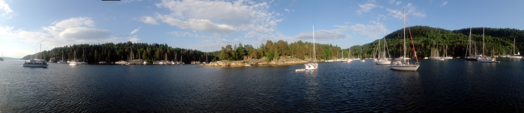
Situated on route from the home port of the western Oslo pleasure boat fleet, to the ‘open’ waters of the inner Oslofjord, anchorage between Ostøya, Kjeholmen and Grimsøya has a steady onset of boats passing through. Every now and then, strange things float by. A sailboat is not strange in it self, but when the crew occupies the hammock while under sail it registers as strange.
A sailing scaffold
..and then there is this.
Ostøya
Latitude: 59° 52.636 N Longitude: 10° 34.712 E
Click chart to view larger scope, or here for an even larger scope in a separate window.
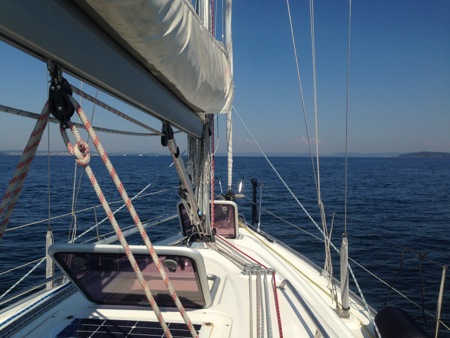
On passage to Holmsbu, across outer Oslofjord. Holmsbu on the horizon (strictly speaking it´s behind the headland).
Holmsbu is a bit of a detour, but it has become a tradition, much owned to the shrimp-sandwich at Juno.
Like most of the week, this day was very calm. We even left the hatches open, something we normally never do. A behaviour we adopted after socking our bunks, in the fore cabin, on a passage as novices.
Ytre Oslofjord
Latitude: 59° 25.301 N Longitude: 10° 32.938 E
Click chart to view larger scope, or here for an even larger scope in a separate window.
On our return we decided to stop over at Hankø, among other to see if we would sight the dolphin again. As we passed Hankø Marina we spotted a free berth. This does not happen often here, so we spun around and berthed. If the dolphin still was in Hankøsundet, it did not hang around the marina.
Hankøsundet
Latitude: 59° 12.818 N Longitude: 10° 47.288 E
Click chart to view larger scope, or here for an even larger scope in a separate window.
For several years Koster has been a destination we wanted to reach on our summer cruises. The closest we ever got was Strömstad, where we more than once have been stuck due to bad weather. This year though, we took advantage of the good weather and made it to Koster.
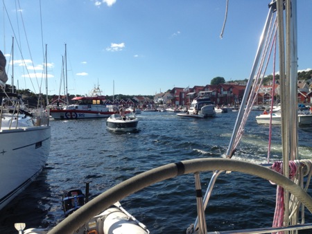
The guest harbor in Kostersundet
The guest harbor looks idyllic, but on the outer dock boats are stacked 5-6 on top of each other. When the crew of the outermost boat decides to march back and forth over the deck of the other boats several times in course of the night, some of that idyll evaporates.
Kostersundet
Latitude: 58° 53.695 N Longitude: 11° 0.829 E
Click chart to view larger scope, or here for an even larger scope in a separate window.
It is our first visit to Skjærhalden. It works better as stop on our way to Koster than Strömstad does. It is a nice place too, but much too busy, at least on this day. There was a constant onset of day-cruisers, very considerately entering the harbor at low speed, and not so considerately leaving a large wake on the way out, soon after. As if not finding a space to tie-up, wiped the consideration off them.
Skjærhalden
Latitude: 59° 1.482 N Longitude: 11° 2.481 E
Click chart to view larger scope, or here for an even larger scope in a separate window.
Sorry, we do not have a picture to show you (illustration: jorymon)
After a stop in Sandspollen, we made it to Hankø on the second day of this year´s summer cruise. Almost immediately after dropping anchor, we had a dolphin swim up next to our boat – slightly on its side as it slowly swam past, as if it wanted to get a better view of the gaping faces stirring down on it. It came by several times, but by the time I had the camera ready it never came close enough or surfaced long enough, for a proper shot.
Bonfire at FB1860 harbor on Ostøya (no people were burned)
We enjoyed the typical ingredients of a Norwegian midsummer eve celebration (i.e. bonfire and boating), in Ostsundet this year. We were not alone, even though it fell on a Monday.
Ostøya
Latitude: 59° 52.595 N Longitude: 10° 34.6104 E
Click chart to view larger scope, or here for an even larger scope in a separate window.
True to tradition, Sandspollen was packed this weekend. The wide angle lens makes it look like there is plenty of space, but it was really packed tight.
Sandspollen
Latitude: 59° 40 N Longitude: 10° 34.828 E
Click chart to view larger scope, or here for an even larger scope in a separate window.
On passage from Son to Dronningen, in moderate wind we had to try the new gennaker (second try). We where running downwind in the Drøbak channel so I decided to fly the gennaker on a whisker pole. Bad idea. The gennaker is on roll, but does not roll as easily as the genoa. When the wind increased, it took some inelegant foredeck work and sail flapping before the whisker pole was rigged down. I also learned that even though the gennaker was rolled up nicely (in headwind), the top soon blew out, so the gennaker needed to be rigged down too.
Drøbaksundet
Latitude: 59° 35 N Longitude: 10° 38 E
Click chart to view larger scope, or here for an even larger scope in a separate window.
Well, it opened for business in 2010, but it is new to us. This harbor works best in good weather. It is pretty tight, we witnessed some bumpy maneuvering even though the conditions were good.
Drøbak
Latitude: 59° 39.558 N Longitude: 10° 37.688 E
Click chart to view larger scope, or here for an even larger scope in a separate window.