Bonfire at FB1860 harbor on Ostøya (no people were burned)
We enjoyed the typical ingredients of a Norwegian midsummer eve celebration (i.e. bonfire and boating), in Ostsundet this year. We were not alone, even though it fell on a Monday.
Ostøya
Latitude: 59° 52.595 N Longitude: 10° 34.6104 E
Click chart to view larger scope, or here for an even larger scope in a separate window.
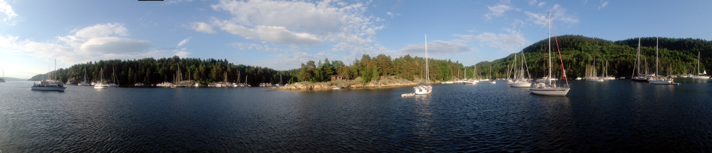
True to tradition, Sandspollen was packed this weekend. The wide angle lens makes it look like there is plenty of space, but it was really packed tight.
Sandspollen
Latitude: 59° 40 N Longitude: 10° 34.828 E
Click chart to view larger scope, or here for an even larger scope in a separate window.
On passage from Son to Dronningen, in moderate wind we had to try the new gennaker (second try). We where running downwind in the Drøbak channel so I decided to fly the gennaker on a whisker pole. Bad idea. The gennaker is on roll, but does not roll as easily as the genoa. When the wind increased, it took some inelegant foredeck work and sail flapping before the whisker pole was rigged down. I also learned that even though the gennaker was rolled up nicely (in headwind), the top soon blew out, so the gennaker needed to be rigged down too.
Drøbaksundet
Latitude: 59° 35 N Longitude: 10° 38 E
Click chart to view larger scope, or here for an even larger scope in a separate window.